What? |
|---|
| Hirakata (枚方市) is most famous for its amusement park, but it can also serve as a getaway from the big city. It shares a range of hills with neighboring Kyoto (京都府) and Nara (奈良県) Prefectures, some of which are part of designated nature parks (Kurondo Nature Park くろんど園地), camping grounds or outdoor activity centers. On the Nara and Kyoto side the hillsides are also littered with small shrines and temples which are half taken over by nature. |
Where? |
The city of Hirakata is located in the northeast of Osaka Prefecture (大阪府) and borders Nara and Kyoto Prefectures. To start walking in the “backyard hills” as I like to cal them, get off at JR Tsuda Station (JR津田駅) which lies on the Gakkentoshi Line (学研都市線) and is an approximately 30 minute ride away from Kyobashi Station (京橋駅) on the Osaka Loop Line (環状線).

|
URL |
| Kansai Culture |
I get a lot of inspiration for my hikes from an app/website called Yamap. There are many people who take the most beautiful pictures of Japan’s highest peaks, but I mainly use it to scan interesting walks and routes in the Kansai region. That’s how I stumbled upon the account of Ross-Barry Finlayson who must have covered every inch of ground in Osaka’s forests. I decided to take one of his reports as the base for an outing nearby. While Mr. Finlayson may call this a walk instead of hike, as it concerns near 19km of walking and a total elevation of over 1000m, I will go ahead and safely call this a hike.
I started out covering ground on the hillsides in Osaka. I soon encountered a first peak with Kunimiyama (国見山284m) which had some great views over Osaka’s suburbs. As swiftly as this peak, the next one appeared. Konozan (交野山341m) must be the most famous spot on today’s hike with its big Kannon Rock at the top, from which you have sweeping views over Osaka’s city center and far beyond.
The going between the start and the exit out of Konozan was very easy and charming, with very well-maintained paths in a beautiful forest that showed the first signs of autumn. The temperature took a drop starting this day, but for a day in the outdoors, today might have had the perfect conditions. And it seemed many people with me thought the same thing, as I was surprised how popular Kunimiyama and Konozan were with the locals.
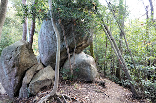
But all this changed at the point where I left Osaka Prefecture and entered Nara Prefecture. There were no more people around (apart from one radio-hobbyist who clearly was looking for uncrowded higher ground) and the easy to tread paths turned into small ditch-like ones. They were still easy to tread, although the disappeared signage made the going a little more difficult. With the third and highest peak for today in my pocket (Hatafuriyama 旗振山345m) I continued onto Ryuosan (龍王山321m) through unspoiled forest and with not a soul in sight. There are no views or panorama’s to be enjoyed here, but just being outside in this beautiful forest felt absolutely great. Also, for me, this stretch contained the highlights of today with big boulders strewn around as if they were the marbles of some extinct species of giant. As the rest of the underground was not rocky at all, I found the boulders all the more mysterious.
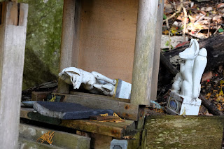
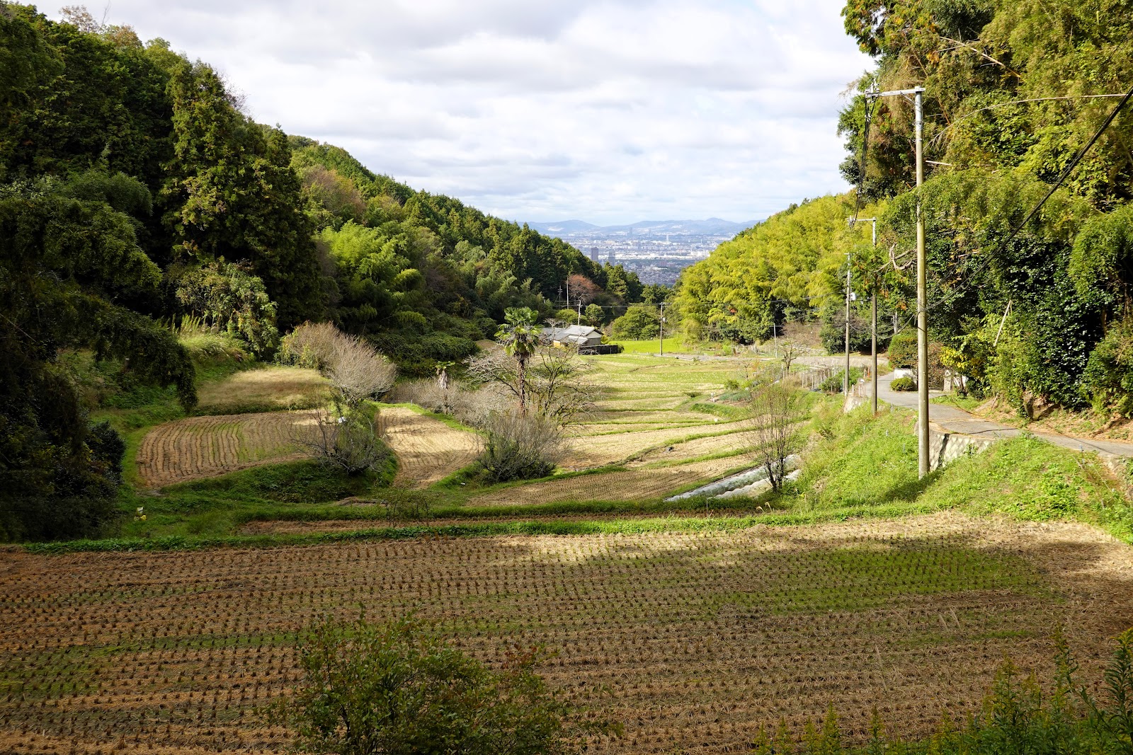
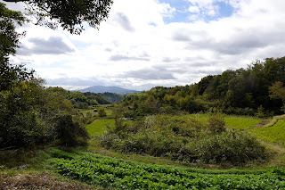
A little bit after reaching the peak of Ryuosan I encountered the first of many decrepit religious signs. A small shrine had seen its icons tipped over, while a few meters away two other shrines were abandoned and left for nature to reclaim. A short walk downwards, the torii entrance to the shrine was also clearly left to battle time for itself. Slowly the small forest path made way for a wider one which suddenly gave way to civilization in the form of rice paddies. It’s hard to imagine that only a hour or two ago I started out in a densely populated mega-city, and here I am seemingly in the most remote of rural towns.
From here on, the road would meander over paved streets in quaint villages for a while.
Some farmer’s fields to the left were the sign to go into the forest again. I would be walking the line between Nara and Kyoto Prefectures to the peak of Senbokoyama (千鉾山311m).
Now, until this point, I really didn’t have difficulties to find the path or to proceed along said path. Here however, I had difficulties to find the way up the prefectural border… and when I found it, I did wonder whether this part of the hike was still in use.
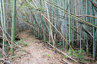
I’m not the one to give up easily though, so I pushed on and after a few meters the path returned to somewhat normal conditions. Small, slightly overgrown and hindered by the occasional fallen tree – certainly, but also clear and pretty easy to follow.
Checking off Senbokoyama I continued straight – the only way to go – until suddenly the path abruptly ended. I scanned the surroundings and saw I signboard a few meters away. I thought I had wandered off the path and headed in the direction of the sign. It actually was a sign telling me that I arrived at the point where three prefectures touched other – Osaka, Nara and Kyoto – but apart from this sign: no indication of the direction to go.
I was reluctant to go back so I briefly tried to whack my way through the forest in the direction my navi pointed me. And with success. Soon a very – I repeat: VERY – faint path opened up. I saw a few signs but all were rotting away, otherwise nothing indicated a route passing here… was this the change in prefecture? Osaka: great paths; Nara: ok paths; Kyoto: where are the paths? Because the same thing would happen again.
Wacking myself out of the forest I arrived at a shrine where I had lunch. Taking the paved road from here on was an option, but my navi showed the existence of a forest path behind the shrine. I can now safely tell you: take the road, because there is no path. I tried – and succeeded – going through the forest, but again: there was no path. Well, some bushwacking can be fun; it didn’t take too long anyway. But eventually you arrive on the same paved road.
After a while the paved road turned again in a forest path, but this time easy to tread. It would lead me comfortably to a picturesque small village that houses the Shuchi Shrine (朱智神社). The shrine was well maintained, so I was surprised – and this time honestly a bit frustrated – that I need to bushwack myself again for around 10 minutes to join a wider forest path. The reason for my frustration was that several plants confused me with some animal and left their sticky seeds on my bright orange fleece, making it necessary for me to pick them off one by one. Well, of course, that’s nature.
An option is to skip the town and shrine and bushwack-path because a rather well-maintained forest path can be used as a way to shorten the hike. I did like the village though, so no regrets.
From here on I would slowly close the loop of the hike and return to Tsuda Station. As I crossed the border with Osaka Prefecture the paths were again in perfect condition. I’d be arriving at the foot of Kuniyama, but not before – for the first time in my 13 years in Japan – I was accompanied by a group of loudly singing girl scouts. Now that was an experience!
Apart from the few bushwacking stretches, today's hike reminded me a lot about both the Shikoku Pilgrimage and the Kyushu Olle courses. It’s a mix of walking in pristine nature and through rural landscape with a few religious points along the way. It makes you calm, it makes you respect your surroundings.
Another great thing is that you can adjust the route to your own level as there is myriad of walking paths in the whole area.
>>More pictures<< |





No comments:
Post a Comment