What? |
|---|
|
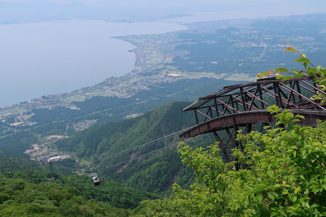
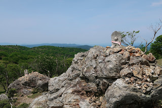
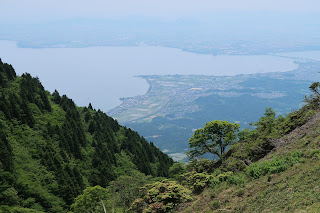
Mount Horai (蓬莱山) is 1174m high peak in the Hira Mountain Range (比良山地). It used to house ski slopes, but as snow barely falls anymore it has been revamped in the Biwako Valley (びわ湖バレイ)). It’s hard to describe what this is. I call it a circus in the title because of the lack of coherence between attractions, but it’s actually pretty interesting. The highlight is the high-class looking Biwako Terrace with relaxing seats and great views over Lake Biwa (琵琶湖) (but this view can of course be seen from every point on the mountain). But there’s also a funny bicycle-course, some games you can find at the carnival, and an adventure-land for kids. I however, came 100% for the hiking experience. |
Where? |
|
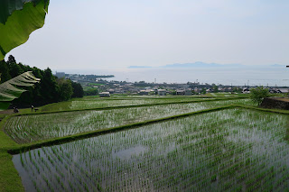
Mount Horai is located in Shiga Prefecture (滋賀県) and can be accessed by cable car. Coming from Kyoto (京都), take the Kosei-line (湖西線) which straddles the west coast of Lake Biwa. Get off at JR Shiga Station (JR滋賀駅) after which you can transfer to a bus that takes you the cable car station. I hiked my way up, but the starting point is the same: Shiga Station. From there I headed fairly straight to the mountains, taking a hiking trail to a huge cedar tree called Tengu-sugi (天狗杉) after passing a dam. The trail is very straightforward arriving at the upper cable car station. A 20 minute walk later – following the ski-lift – takes you to the top of Mount Horai. I descended the mountain by looping away from the Biwako Valley towards JR Horai Station (JR蓬莱駅), only one station away from the starting point. 
|
URL |
| Biwako Valley |
There are many blog entries that I start my referring to me and my friends’ failed hike at the Yatsubuchi-no-Taki falls. Every time I recall that hike, it seems to have become even more hazardous in my memory. In the meanwhile I have climbed several other mountains without problems, but in my mind the mountains in the Hira-range were extremely dangerous with very badly taken care of paths and trails.
Of course that’s completely untrue – it was just horrible preparation that resulted in the legendary Yatsubuchi-no-taki hike.
Nevertheless, it took until today before I dared tackle a Hira-mountain on my own. I took an easy one because of the escape route it offered in the form of the cable car (that line of thought was the same at Yatsubuchi, but this time I was sure it still existed!).
But as I kind of already knew, my fears were not founded on any facts. The way up was straightforward and easy. I mean, yes, it’s 1000m upward without any flats or downs, but the many switchbacks make for easy hiking if you have a good rhythm.
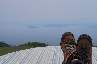
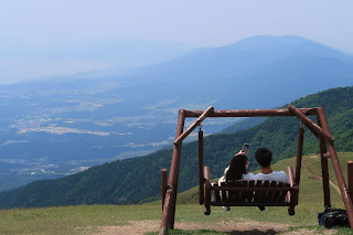
At the top I didn’t dare to enter the Biwako Terrace – you know, being smelly and all – but I did enjoy the 360° seats which are also not your everyday mountain-top installation.
Many of Japan’s beautiful mountains are ruined by ugly relay stations or decaying souvenir stands, but I must say that I quite enjoyed the atmosphere of the strange “village” that they built here. I might come up here again by cable car with my family.
I made some really great time and was convinced the way down would be a breeze. Why yes, there were some hazard marks on my map, but you have to know that Japanese people even put hazard marks when a young tree happened to fall on a path 10 years ago.
But standing in front of the path going down I immediately realized these hazard marks were justified. A bone breaking steep descent rendered even more dangerous by a path that solely consists out of landslides and big, loose rocks.
At first, the worst thing that could happen is slipping on one of those rolling rocks, falling badly and break a leg. After a while though, the path started following a stream, but 5 meters higher. So if you slipped here you might as well fall down, hit the huge rocks in the stream and then get buried by all the rocks from the path that followed you in your fall.
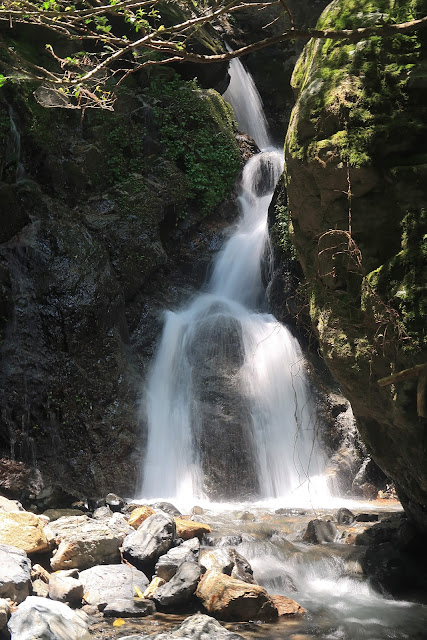
These horrid visions made sure I was extra careful, and thus extra slow. And the fact that the stream was absolutely gorgeous made me go even slower. After a while the path started to ease a little, getting on an even level with the stream and with comfortable switch-backs. The stream and its many cascades were truly beautiful and I was happy as a kid when the path crossed the stream several times. The absolute highlight of the stream was the Yakushi Waterfall; not the highest, not the greatest, but beautiful nonetheless.
Not long after the waterfall the path turns into a paved road. But even though you cross a highway and get closer and closer to civilization, the road has the feeling of being in the middle of a forest until just before arriving at Horai Station.
It’s possible to this hike the other way around. Signage at Horai Station is better than at Shiga Station (where it’s pretty non-existent), and the rocky path might be safer going upwards than downwards. I would recommend though taking it the way I did, because the beauty of the stream won’t allow your mind to think about fatigue, and it makes the hike interesting until the end.
>>More pictures<< |




No comments:
Post a Comment