What? |
|---|
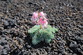
| Mount Akita-Komagatake (秋田駒ケ岳) is an active volcano located in the Towada-Hachimantai National Park (十和田八幡平国立公園). While the access road is closed in winter, in the warmer months the peak is a popular spot for its many hiking trails, ranging from real easy to intermediate level. A lot of mountain flowers can be admired, but most of all the locals are fond of the Komakusa (Dicentra Peregrina, コマクサ). |
Where? |
|
Akita-Komagatake is named as such because of its location in Akita Prefecture (秋田県). The most common trailhead is located at the 8th station (八合目). In summer months, the last part of the road towards this station is closed for private vehicles, but instead shuttle buses ride between the Arpa Komakusa (アルパコマクサ) parking lot and the 8th station, or less frequently between Lake Tazawa and the 8th station. Access is easiest by car, but with careful planning you can take a train from Akita (秋田駅) to Lake Tazawa (田沢湖駅) and transfer there to a shuttle bus. 
|
URL |
|
Japan Guide Outline Towada-Hachimantai National Park |
In normal circumstances I flee the ridiculous heat of August by flying back to my home country. With the corona virus making flying internationally a complicated affair, I decided to head for the cool north.
Well, naive me. Akita was a boiling oven as Osaka ever was. But surely, climbing a mountain at 1600 meters above sea level should be more bearable, no?!
I departed early in the morning to catch the shuttle bus at 7:42. At the bus stop the thermometer already pointed at 28 degrees Celsius.
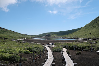
But arriving at the trailhead several hundred meters higher, the air felt cool and fresh. Taking off the mouth mask also helped of course. And while the hike was pretty easy and relaxed all the way to Onamedake (男女岳), from the moment the climbing - or in my case descending - became a little harder, the sun was unrelenting. From around 11am the conditions were brutal.
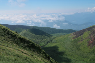
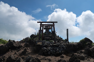
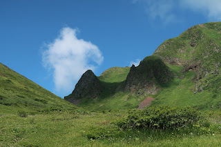
But that being said, the continuous view made possible by this almost cloudless sky was absolutely gorgeous. I first hiked Odake (男岳), descended into the valley and hiked back up again on some loose volcanic sand towards Onamedake. After that I traced my steps back to Yokodake (横岳) to hike back to the 8th station trail head via Yakemori (焼森).
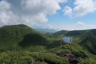
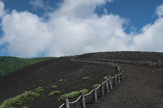
In hindsight, it might have been better to climb Onamedake, go down via the volcanic sand trail (it walks like a beach, so going up was a bit annoying), pass the valley and climb Odake. The descent from Odake into the valley was a bit dangerous, but a slower ascent shouldn’t be too hard. An additional bonus is that you save the best for last, because despite its lower altitude, Odake has a much better views than Onamedake; there’s a whole panorama ranging from the central Amida Pond over the Medake crater, and even a clear sight of Lake Tazawa.
I was a bit afraid of the access to the mountain, as the last part towards the 8th station is a small and winding mountain road. It gave me a flashback to my failed hike in Shikoku. So I was very happy when I discovered the existence of the shuttle buses which makes getting to the trailhead a breeze. Also the hike towards Onamedake is very easy; the loop around the peak ending at Amida Lake is possible for anyone with a very basic condition, and also the climb to the top is perfectly doable. Reaching the more impressive Odake is a little tougher, but still shouldn’t pose any big problems. These hikes are easily accessible, easily doable and have great views, so I recommend Akita-Komagatake to anyone who happens to pass in the vicinity.
For a little more challenge, you can take of the many other hiking courses which intermediate level.
>>More pictures<< |




No comments:
Post a Comment