What? |
|---|
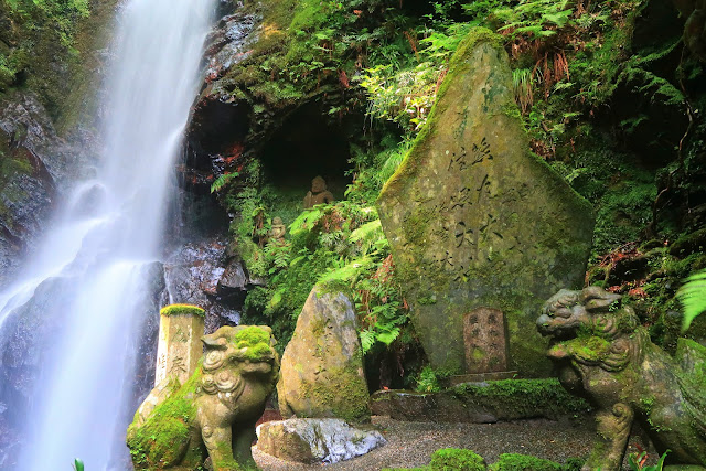
| The walk between Takao (高雄) and Hozukyo Station (保津峡駅) follows the Kiyotaki River (清滝川) all along the way. At the start of the route there are a few temples, but they don’t compare to the beautiful nature that comes next. The absolute highlight can be found after a little detour: the Kuya-no-taki Waterfall (空也の滝) would be pretty as such, but it’s simply impressive with the religious artifacts around. |
Where? |
|
The walk starts at the Takao bus stop (previously known as Yamashiro-takao bus stop), a 50 minute bus ride from Kyoto Station (京都駅). It goes all the way to the JR Hozukyo Station (JR保津峡駅) from which you can take a 20 minute train ride back. I could go into detail, but really, this site is a perfect step-by-step guide (just remember that the name of the bus stop has changed). 
|
URL |
|
Inside Kyoto Tales of Trails |
Here’s an easy and beautiful walk that can be done anyone with the ability to walk around 10 kilometers. No rough terrain, no considerable height differences and no tough navigational decisions to be made.
And yet we found ourselves lost (almost) two times.
For the route, I just refer to Inside Kyoto. Apart from the bus stop which has changed names from Yamashiro-takao to simply Takao, you can’t go wrong if you follow the author’s instructions.
I was a fool to rely on my navigational skills of which I was convinced they had improved since the Yatsubuchi Falls hike.
Getting off at the bus stop, you just go down the stairs and the walk immediately starts from here. If you like temples and shrines you can visit the nearby ones, but we just immediately started following the Kiyotaki River.
The rain of the previous days had definitely made the vegetation greener and the stream flowing steadier than usual. But as today came with perfect weather, this stream-side walk was absolutely timed to perfection. We should have taken a barbecue set and swimming gear with us, no doubt.
Even though Kyoto is not far away, the nature we were walking was more than mesmerizing enough to forget about any city life.
You can decide to follow the stream all the way to the end point Hozukyo and not get bored despite just going straight and downstream.
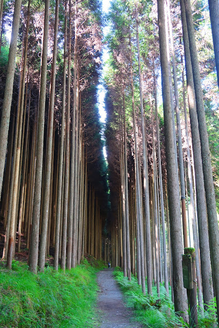
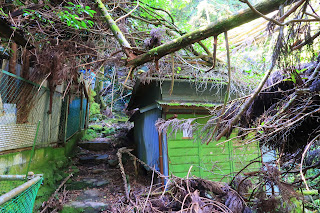
But as Inside Kyoto mentions, it’s very much worth to take the detour to the Kuya-no-taki Waterfall. The approach goes through a forest and becomes absolutely fairytale-like after around 20-30 minutes when you reach the stairs towards the falls. Immediately before witnessing the falls in all its glory, there are some buildings who spoil the moment, but they were half blown away by some typhoon from the previous years, leaving you in awe of nature’s force.
The waterfall is absolutely breathtaking with a small torii in front of it, lit candles and a small cave with Buddhist statues next to it. Really a sight to behold.
And worth the extra detour that me and my companion did.
Because while the way towards the falls is simply straight on, I guided us for some unknown reason upon a mountain path going up, up and up until I realized we should have already been there. I suppose we were on our way to the top of Mount Atago (924m), but as it wasn’t our goal we backtracked, got on the right road and only lost around 40 minutes.
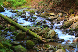
After the falls we went back to the river and continued our way to Hozokyo, having lunch on one of the many accessible rocks in the river. We didn’t have swimming gear but the sun invited us to kick off our shoes and wade a little bit through the stream. Not too far as it was stronger and deeper than it looked.
The continuation after lunch was even more picturesque, leaving civilization even further behind, fully enjoying the river, the sounds, the peculiar geographical features of stones and rocks, and (easy) bolder-hopping from time to time. Small waterfalls, snakes and frogs, oddly shaped trees, it all seemed like a new wonderland.
Almost to the end, the Kiyotaki river gives way to the bigger Hozu River, and here’s where we almost got lost again. Full of confidence I turned left and declared that we would soon pass a tunnel. My companion took a short look around and cheerfully notified me that there was one on the right. Apart from the tunnel being actually visible, there was also an arrow indicating the correct direction.
Seriously, what was wrong with me??
The walk enters its final phase here, and loses a bit of its charm as its over asphalt and with cars regularly passing by. Nonetheless there are still some points of interest. Just after leaving the tunnel you can see where the two rivers merge, and in today’s perfect weather we could see the wooden boats of the Hozu River Cruise passing by, as well as rubber canoes and beer drinking enjoyers of life in inflatable tubes.
At the end of the hike there are two stations. The first is the station for the small tourist train (torokko) which made an appearance as if just to please us. The second and absolute endpoint of the hike is the JR Hozukyo Station which is located on a big bridge and which is a sight in itself.
Today was a near perfect day for this kind of hike.
Really, next time it’s barbecue time.
>>More pictures<< |




No comments:
Post a Comment