What? |
|---|
|
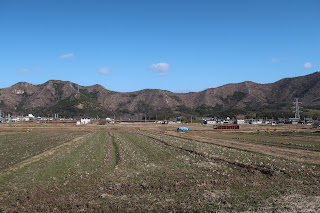
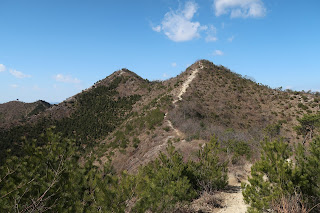
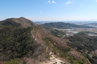
Harima Alps (播磨アルプス) is a cirkel of stony hills around an irrigation plateau a little bit before Himeji (姫路). The highest point is Takamikurayama (高御位山) at 304 meters, which is connected by a popular steep stone ridge with Takanosuyama (鷹ノ巣山) which is actually a twin peak at 265 meters. The low altitude shouldn’t fool you as the trail goes steeply up and down at least 5 times. |
Where? |
|
The Harima Alps are located in Hyogo Prefecture near Himeji. It’s easily reached from Osaka (大阪) by taking the JR Kobe Line (JR神戸線) to Himeji, getting off at Sone Station (曽根駅). There is also a Sone Station in Osaka Prefecture, so don’t pick the wrong one! The fastest way is to take a special rapid service and transfer to a local train at Kakogawa Station (加古川駅). 
|
URL |
|
Hiking in Japan Immersion Benkyo |
I mainly followed the trail as described on Hiking in Japan, so exiting the station I turned to the east side of the hills. As described I arrived at a small shrine which clearly was the trailhead, but a big plate and a fence stating that this was private property and not allowed to pass for hikers made me quickly change my plan. I just followed the street on the left flank of the hill until I arrived at another shrine/temple with a big billboard depicting all hiking trails. The trailhead was actually fenced off here too, but no signs regarding private property made me assume it was a fence to keep out wild boars. I opened the gate, closed it behind me, and got on my way.
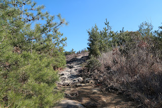
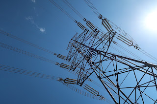
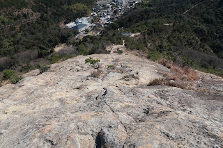
The ascent immediate was typical for the whole hike to come: steep, bald, rocky, and with beautiful views at pretty much every step you take. The electrical wires didn’t even bother me a little bit. The valley with its many small irrigation lakes and the view of the steep trail ahead didn’t bore for a minute, but it were the twin peaks of Takanosuyama that impressed me the most. They really look beautiful from any angle. Of course, I was aided by nearly perfect weather: blue skies, not too warm, not too cold, just a little windy.
The ascent to Takamikurayama was steep but smooth, just as the passage to Takanosuyama. During this part of the trail I encountered many hikers who made good use of the fantastic weather.
At the twin peaks I had my lunch and continued the circle. Many people just descent straight into the valley from here, just as they attacked Takamikurayama straight on.
The parts on the east and the west from these points are clearly less impressive, but the lack of people here keep them interesting enough.
In general the hike went pretty smooth, although the last two saddles left me with several blisters on my feet, the result of the many steep slopes up and down. So despite the rocky surface I would suggest wearing tightly fitting sneakers so to spare your soles and toes from shuffling forth and back in your shoes. Also, definitely avoid this place when raining or when still wet. A slippery underground here is downright dangerous and could be fatal.
In any other circumstance: enjoy these charming hills and the beautiful views they offer.
>>More pictures<< |




No comments:
Post a Comment