What? |
|---|
|
Mount Kokuzo or Kokuzosan (虚空蔵) is 596m tall mountain in central Hyogo Prefecture (兵庫県). There is an easy to reach hiking path that takes you along the mountain ridge between two neighboring train stations. The mountain has some nice views over nearby villages and the many small mountains and hills of Hyogo prefecture. |
Where? |
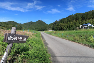
The easy to spot trailhead is a 15 minute walk from Aimoto Station (藍本駅) on the JR Fukuchiyama/Takarazuka Line (福知山線 / 宝塚線). It can be reached by direct train from JR Osaka station. The hike ends near Kusano Station (草野駅) on the same train line, but I strongly advise to start the hike in Aimoto.

|
URL |
| Visit Hanshin |
I planned for a short, uneventful, fairly relaxing hike to keep myself in shape. As I am writing this, I realize I got a little more than I bargained for though.
First of all, let’s start with the word “relaxing”.
The last time I hiked in August is already quite a while ago. The more time has passed, the easier it is to forget things. I know Japanese summers are hot and sticky, but as I had gotten through this year’s temperature record breaking summer fairly ok, I maybe thought that some friendly people had installed fans and air-conditioning along the way.
I did decide on this particular hike because the time spent walking mostly happens underneath the foliage of the trees. And while yes, the shade of the forest is way more bearable than the concrete jungle of the city, it doesn’t make the Japanese summer any less brutal.
Things started out ok though. Getting off at Aimoto station, the 15 minute walk to the hiking trailhead was exactly how I had imagined it. A small unmanned station, a few traditional houses in a charming state of disrepair, a local train track with the odd train passing, rice fields in various shades of green, … it was a bit like a nostalgic scene from a Japanese animation movie.
It was still early and the walk had been flat up till then. I might have been misled by this and the many colorful salamanders I saw, but once in the forest, I was catapulted back to reality. I immediately started sweating as if a sauna fell onto my head, and while I usually am a swift climber, I had quite some difficulties with the steepness of the climb combined with the very rocky underground. The fact that my muscles were still sore from an impromptu gym session two days before also didn’t really help.
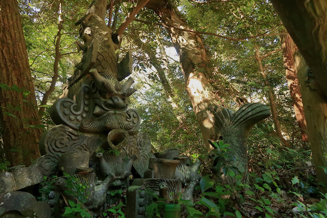
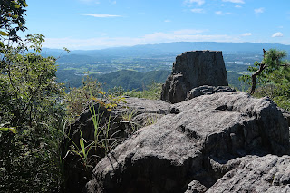
But still, the path was clear, the foliage protected me from most of the heat and I really liked the section from Aimoto station to the top of Mount Kokuzo. A well-maintained, sober shrine and a big protruding rock with great vistas were the highlight of this part.
In my naive opinion, the hard work was done. From here on, the hike would take me along a simple ridge walk, passing several lesser peaks while slowly losing altitude, and then end in a gentle descent towards Kusano Station. Approximate time: maybe a little over two hours.
So I continued on my way. Already I noticed that the ridge path wasn’t maintained as well as the route from Aimoto station to the peak of Mount Kokuzo. Even where there were manmade stairs, I found them quite slippery and as such pretty dangerous.
It was at this stage that the “uneventful” part of my initial plan fell apart.
A fellow hiker approached from the opposite direction and greeted me, as is the polite thing to do. Usually the communication ends here, but this time the fellow hiker dug up an old, somewhat crumbled paper map and started asking me where he was. He wanted to go to Kusano station but had gotten hopelessly lost and was starting to panic a little bit despite the still very early hour.
My first reaction (in my head) was: “relax, it’s an uneventful, straightforward hike”. But then I thought: “well, I was already mistaken by the ‘relax’ part, don’t dismiss the information this hiker brings you so easily”.
So as I was going the same way anyway I suggested continuing together and I would track us with my gps. The fellow hiker was visibly reassured not to be alone anymore, but as he was walking ahead of me in a good pace, I didn’t want to tell him that at a certain point he went east where my planned route went west. Anyway, although the eastern path didn’t show up on my hiking app, it was clearly better maintained than the ridge hike, and we were walking in the correct direction, so I just went along.
The path we took was cool and easy to walk, and soon we arrived on a route indicated on my hiking app that would lead straight to Kusano Station. I briefly considered going all the way down with my fellow hiker, but I wanted to return to my initial hiking plan, get to the ridge and check off the various peaks. So I bid farewell to my fellow hiker who now just had to continue straight to the station, and tried to find the path on my hiking app that would lead me straight to a peak called Hachioji. Usually the paths on the app are well maintained ones, but I had a hard time finding the point where I had to deviate from the way we came. Eventually I found it, I took it and struggled, scrambled, crawled to the top. Clearly, this route is in disuse: overgrown, way too steep, no real footholds, and heaps, heaps, heaps of spiderwebs ready to hit you in the eye. No wonder my fellow hiker got lost, as on his paper map it said he had to take this exact route. I went up which was tough enough. Going down would be downright dangerous.
Rewind a little bit, to the point where I contemplated the slippery state of the manmade steps. Why did I consider them slippery, I hear you say. Well, out of experience.
A little before I met the lost hiker, I had slipped and gracefully kept myself straight with the help of some sturdy branches. My camera though lacks my elegance though and smacked hard against the rocky underground.
It’s not the first time I let it drop, but it was only after I crawled my way to the Hachioji peak that I noticed it was refusing service. Not all the time, so I still had the chance to take some pictures, but 80% of the time.
I’m afraid soon it will be time to say goodbye.
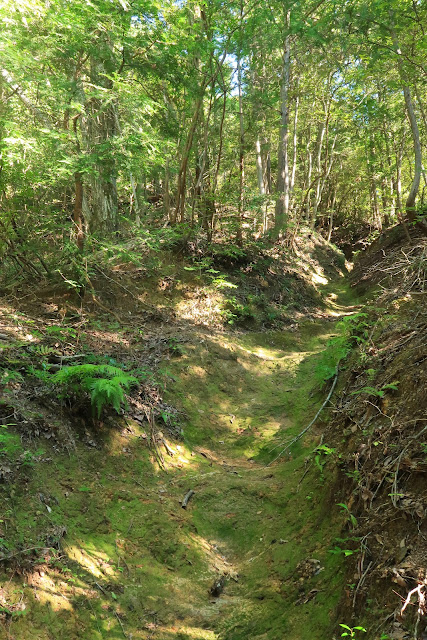
Out of breath and with a broken camera, I continued my way, finally on the ridge I initially intended to take. Just like the steep section I just sludged myself up though, as the ridge route is in pretty bad shape. It’s overgrown in many places with plants and trees, and I surely must have been the first to pass here in a while given the ever-increasing amount of elaborate spider webs. The rocky underground also never gave way to something more comfortable, making it one of the tougher hikes I have been on. I wanted to make good time but just couldn’t. So the “short” part of my initial plan also wasn’t very on point.
Nevertheless, I didn’t regret getting back to the ridge. All uncomfortable things set aside, there are various viewpoints with beautiful views all around. The Hyogo mountains surely aren’t high and spectacular, but seen like this on bright day the sure are beautiful.
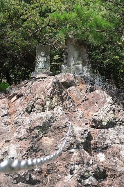
Additionally, towards the end of the hike there is a big bald rock that you can climb with chains to reach two small jizo statues. Again, it’s not spectacular, but it’s charming, it’s authentic, and also from this spot there are sweeping views on the surroundings.
Eventually, after a descent that seriously challenged the soles of my shoes and my toes in those same shoes, the mountain path - or the thing that used to be a mountain path - abruptly ended. I just emerged from the dense forest in what seemed to be someone’s backyard. A snake greeted me, luckily turning its back as I assumed it was a venomous Mamushi.
I walked a few meters to the asphalted road, a bit bewildered that the spiderweb ordeal was finished so suddenly. I don’t know what I was waiting for, but if it wasn’t for a climax, then surely it was for something of a gradual exit outside the forest as is usually the case. Looking back on where I emerged from the forest I couldn’t even make out where the path was. Getting back to those Japanese animation movies, this felt like Spirited Away where I just got out of another world.
If you attempt this hike, walk it in the direction from Aimoto to Kusano. Near Aimoto, the trailhead is a breeze to find. In Kusano, you wouldn’t find the trail even if you were standing on it.




No comments:
Post a Comment